
 Share on bsky
Kisatchie National Forest from Richard May on Vimeo.
It’s the quiet I love about backpacking — and I don’t mean the absence of noise.
What I mean is the quieting down of things and people vying for attention. When walking, none of these matter. I am only with myself.
Escape from urbanity started the day before I hit the trail. Starbucks let me out a half hour early and I bolted. It was dark when I arrived three and a half hours later.
The moon was full. I set the tarp to shade me from the silver light illuminating the parking lot landscape. My spot was just behind the information sign urging me to “leave no trace”.
This hike had been in the works for weeks. Not that I expected any particular difficulties. After all, it’s early summer and the weather forecast put the highs in the mid 80’s and lows above 50F. On relatively gentle terrain, with under 10lb (4.5kg) of gear and food, the 28 miles (35.7km) I had traced in the Kisatchie National Forest should be fairly easy.
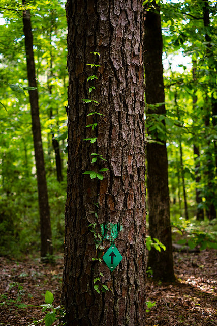
The Kisatchie Hills Wilderness Trail — known as the Backbone Trail — is a horseshoe loop curving out east and north. I started at a brisk pace. Every step crunched underneath my feet on the loose soil.
I was exited. Here on out it would be nothing but me, my footsteps, the birds and the wind.
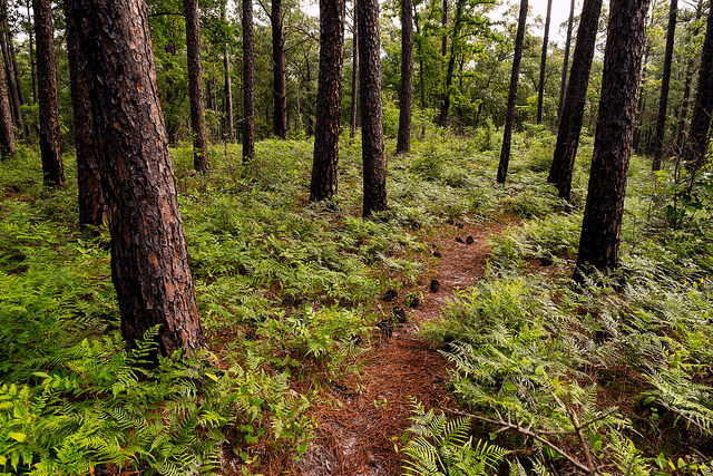
At first the trail is a landscape of burned trees and open canopy with a thick underbrush. Stands of juvenile Longleaf Pines interspersed throughout. Every tree bears the scorched scars of the 2010 Wrangle fire.
This isn’t necessarily a bad thing. Birds are attracted to open areas and most of my time on this trail I was accompanied by birdsongs.

After an initial gentle climb the trail meets up with the Turpentine Trail that leads back to the Longleaf Byway (1.4mi / 2.2km). By this point the forest has been changing and Longleaf Pines are abundant. This is one of the last remaining enclaves of this endangered habitat in Louisiana.
The trail rolls up and down with the terrain alternating between pines at the top of the hills and bottomland forests crossed by streams. Bottomland forests are very different. They are abundant with magnolia and elms. Unlike the airy, thin pines these trees are thick with abundant canopy. I found myself mostly walking in the shade. Even when the sun was high.
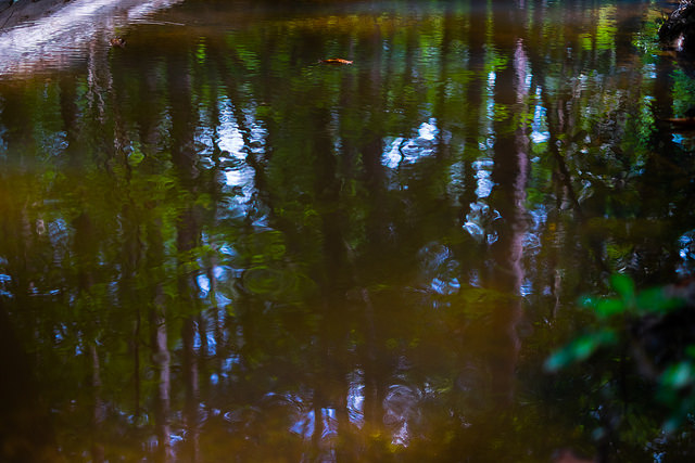
At Cypre Bayou I stopped. The silent stillness is engulfing. The air does not move and the river runs silent like a secret across sandy shores. A lone birdcall echoing through the trees invited me to take my time.
Down here even the low rumble of jets flying over head is muffled. The eerie stillness is a cool break from the sun atop the hills.


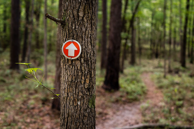
Shortly afterward the trail climbs to the top of a ridge which it follows in a very fast and almost perfectly level straight line. The ground is soft beneath my feet and it’s cool and shaded. It’s a short couple of miles and I find myself exiting the trail and headed down the road to connect with the Sandstone trail.
The Sandstone Trail, a 36 mile loop of which I hiked just under 8 miles (12.7 km), is open to ATV’s as well as horses. The track is wide and sandy. Many areas have been turned to large puddles by the ATV’s. I tried walking through the damaged portions of trail but my feet remained soaked for too long and eventually I developed a blister.
I was pushing myself, somewhat worried about making camp in time. The ball of my right foot developed a burning sensation that at first was just a little discomfort and later began to hurt. I should have stopped just to dry my feet.
Instead, I pushed forward impelled by the rhythmic pulse of my footsteps. The rhythm of the walk becomes the heartbeat. The rhythmic echo is a tether to the present and a place to return when I find myself lost in my head.
Upon reaching my planned camp zone in the mid afternoon I knew I could reach Kisatchie Bayou Camp in time to set my tarp and cook dinner.
So I pushed on against my better judgement. Pride.
The blister hurt and was buried deep beneath layers of thick skin in the middle of the ball of my foot. By the time I reached the campground the regular push of each step had squished the bubble towards my toes. Had I stopped to dry my feet I’d have been fine.
My legs were so tired that doing anything but walking was a chore. Setting the tarp, cooking dinner and getting sleep were all I wanted. That day I covered 17.73 miles (28.54km). I hadn’t trained for that kind of effort and my body felt it. The extra four miles were done purely to show I could do it.
Yeah, I’m proud I could do it. I’d rather have dried my feet, made more pictures and listened to the birds a little more. I slept very well that night.
Just before dawn the birds started singing. They sing for many reasons; probably related to protecting territory or finding a mate. Whatever, I enjoy it. It’s a delightful cacophony of chirps, cicadas, whistles, caws and echoes. None of which I recognize.
I lay there listening. I’m getting ready for today. It’s quiet. I haven’t seen another person since I left work. Today will just be 10 miles; I’ve eaten most of my food. My bag is lighter, probably around eight and a half pounds. My feet are dry. That blister hurts.
Time to get up.
Slowly I climb out from under my quilt and out of the bivy. It was a tad chilly last night. My legs are stiff and sore. I can hardly put my weight on my foot. I’ve got ten miles left. It’ll be easy. I’ll take my time, listen to the birds, make pictures and pamper that blister.
So I start out.
I followed the Caroline Dormon Trail north through the bottomland forest back up to the ridge where the Backbone trail begins. These forests are beautiful. They are full large old trees and wide open spaces. The light allowed by the canopy is magical.

My footsteps landed softly on the leaf covered ground. The rhythmic pulse once again became my primary companion. My mind was quiet. The scenery still and nobody was there to bother me.
It took a full day of walking to let go of the pressing need to be anywhere but now. It probably helped that my camera batteries died and I couldn’t even think of getting pictures. It really was just me — and my footsteps.
Then I heard the grunt. And it wasn’t friendly. I looked to the right, across the river and connected with a small, black haired mammal. She — I knew this because there was little one with her — was staring right at me.
I froze. She froze. Our eyes locked.
I spun through all I could remember about bears. So I just stood there as quietly as possible. I hadn’t done anything to provoke her — yet. She was ready though. Her weight was shifted forward ready to charge. She grunted and fake charged. I stayed perfectly still.
With that she turned away and took her baby with her. Of course, they crossed the river at the bend and were on my side of the water now.
I stood there a few minutes to give her a chance to move along and away. I debated what I’d seen. Sure looked like a bear. Though it would have been an awfully small one.
Maybe it was a wild hog. A very big one.
Of course, she’d gone the direction of the trail and we met up again. This time at half the distance. Same routine. Eyes locked. Stand still. Let her go.
Later I learned that the small Luisiana Black Bear has been confused with hogs by hunters. I also learned that there are no bears in this part of the state. A ranger who works in that forest also confirmed it had to be a hog.
I probably saw a really big and powerful hog ready to charge. She was amazing.
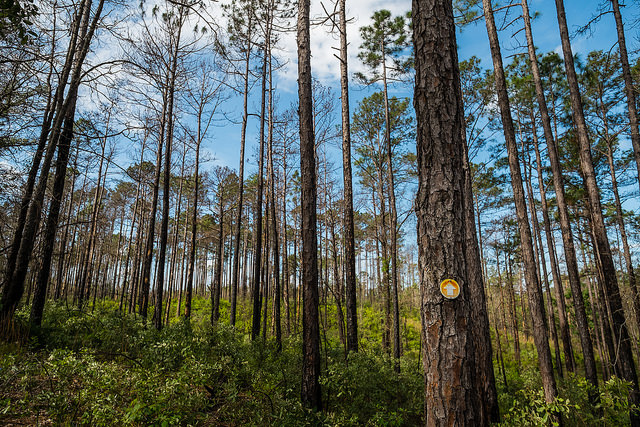
Energized by the encounter I moved on. The trail gradually climbs the ridge from the bottomlands and the ecosystem changes again to pine.
Here out I walked alone. Sometimes along the river. I crossed streams and enjoyed the forest shade.
It was pleasant. My mind quiet but every so often my foot asked “How much longer?”
By two o’clock I was back at the car.
Time to go home.
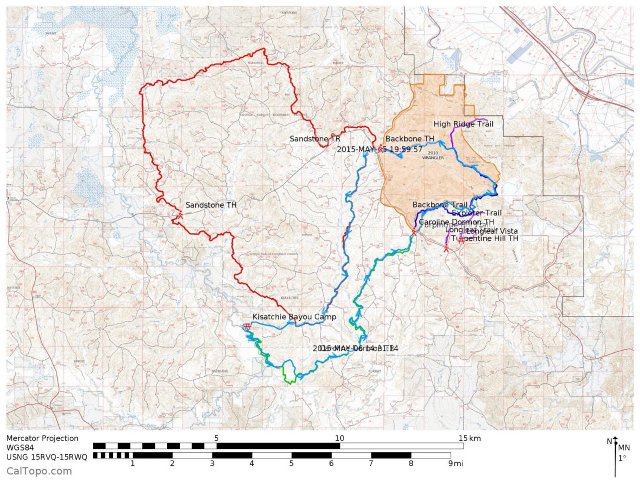
GPS Tracks & Maps
Data geeks like me will enjoy this map. I’ve traced the trails in this area. From here you can download the topographic maps for printing or analyze my GPS tracks.
~
Author: Richard May
Editor: Caroline Beaton
Photo: Richard May


Read 0 comments and reply