
 Share on bsky
How I Found Paradise, Pretty Close By.
In Tibet and India (at least) legends speak of hidden lands, usually deep valleys cut off from the world.
The oak zone.The best known are Shangri-la and Shambala, where “inhabitants developed powers of clairvoyance, swift long-distance travel on foot, and also the ability to materialize and disappear at will.”
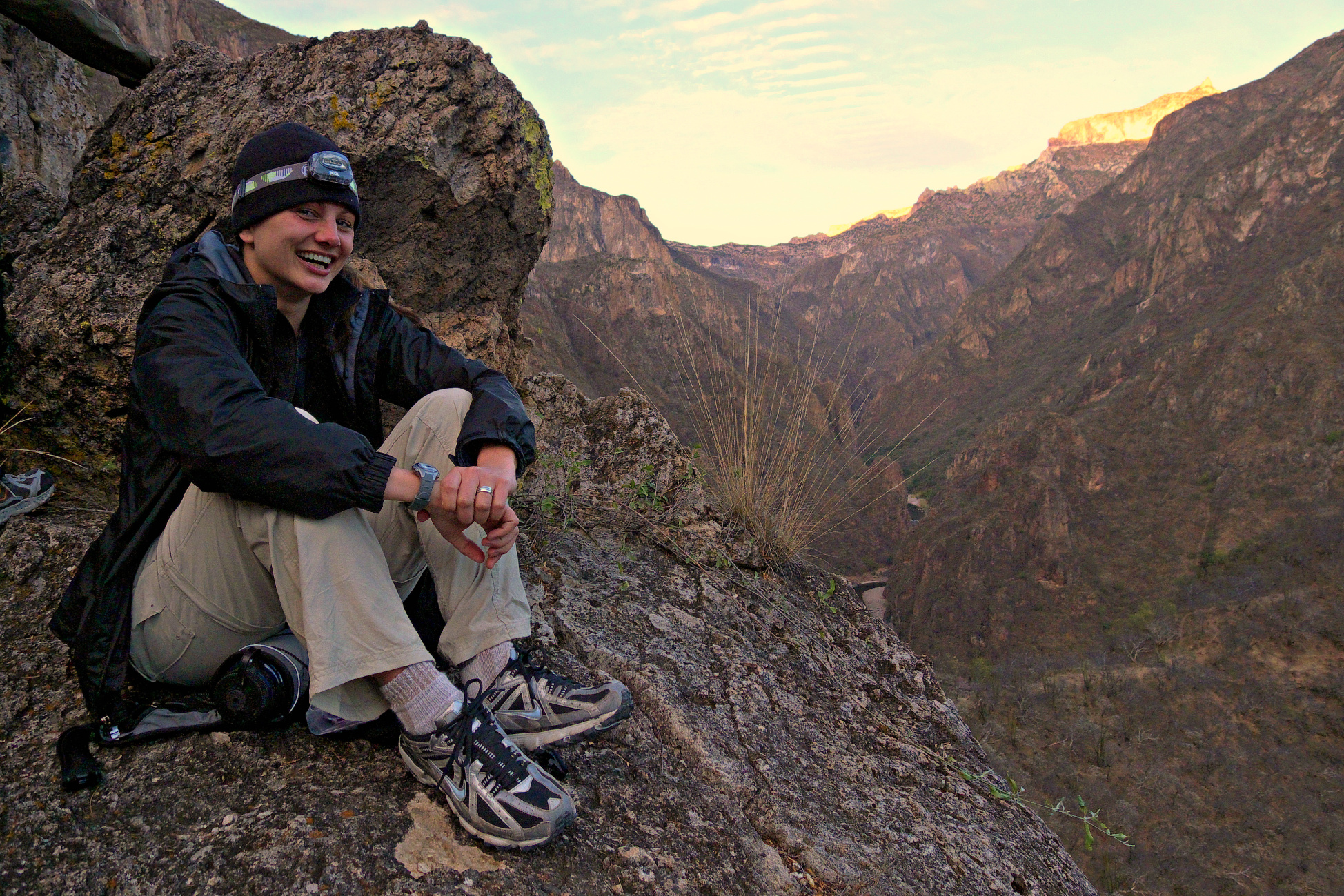
- Tom at camp by the Upper hot springs.
Explorer Ian Baker spent decades getting to perhaps the most-hidden land, involving the help of the Dalai Lama, extreme rock climbing skills, and National Geographic Magazine. His book is The Heart of the World: A Journey to the Last Secret Place.
However, secret places abound in a world where most folks stay on the paths most traveled by. Naomi Levine described one hidden land in elephant journal in August.
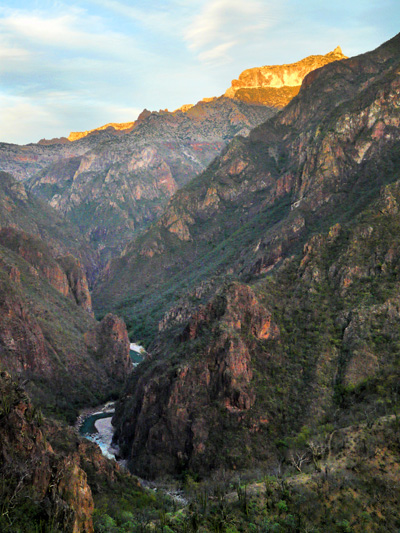
Just 1,100 miles from Boulder in the Sierra Madre of Mexico lies the misnamed “Copper Canyon.” It is actually the world’s largest maze of canyons, as deep or deeper than the Grand Canyon and totaling some 750 miles, three times longer than the Grand. Only two (spectacular) roads descend to the bottomlands, each to a town of about 1,000.
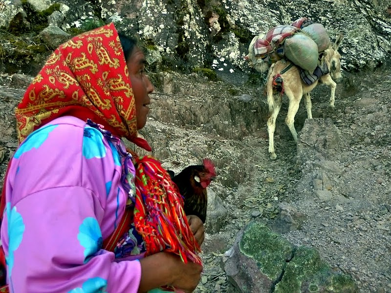
Most of the rest is wild, inhabited by a few Tarahumara Indians, renowned as the world’s best long-distance runners, made famous in the best-selling Born to Run, whose main character is a longtime Boulder friend, Micah True, AKA Caballo Blanco.
The Tarahumara are also reputed to have clairvoyance, and I can testify they’re superlative at hiding, if not actually dematerializing!
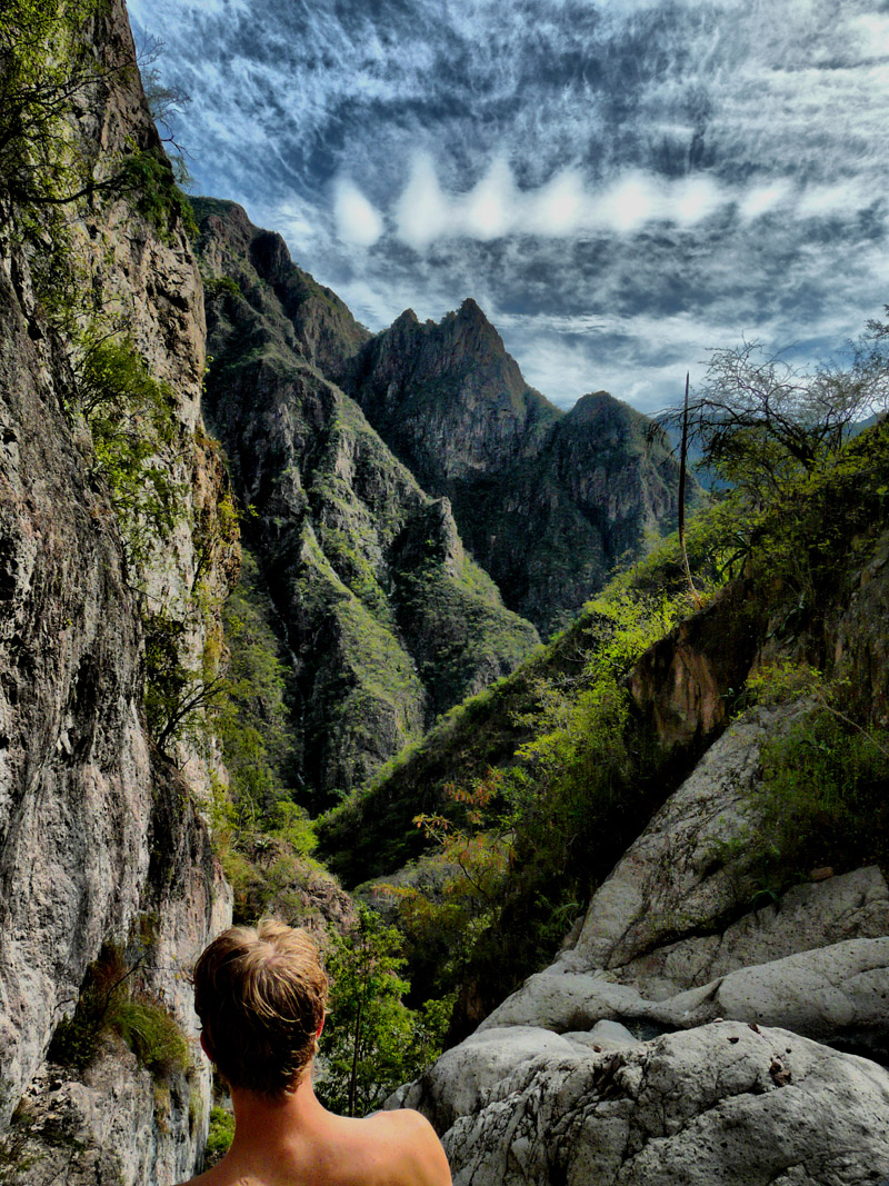
I’ve been exploring the canyons since 1984, and by now know some 75 miles, including one steep difficult stretch where there are many waterfalls, side canyons and hot springs. I go back time and again for a warm, beautiful, powerful spiritual experience.
Hamid & Steve in the Inner hot springsI do lots of yoga and mediation, exploring, photography and reading. Here’s my new video, my first editing. Best viewed at 720p. It’s 43 minutes long and pretty amateur, but hey, it’s a timeless place and I love it!
Copper Canyon was my first stop in Mexico in 1984 when I started traveling, working and living there. The lure down the wicked slidey steep trail was a warm spring a friend had found in a side canyon by dipping his toes into every side stream as he walked along the Rio Urique. I found them and camped by a nearby orange grove for a couple of weeks. A Tarahumara family of five lived in a one room rock and log house on the 200′ high rock ridge towering above. Esteban, the father, visited with me for a couple of hours a day. He’d built his entire house with an ax and knife. I learned much of my first Spanish from him, laboriously consulting my father’s old Spanish-English dictionary.
Tarahumara woman leaving canyon for the season.He told me of a really hot springs a few miles downriver, up another side canyon ( the “Upper hot springs”). I found ’em, and they became my base camp for many years. Twenty years later, I was there in April, when most of the natives had left for the highlands to beat the 100-degree heat. I re-visited the warm springs. The side stream had partly dried out, leaving a big previously-cold pool very hot! I figured out how to regulate the temperature using the side stream, and now I use this (“Inner hot springs”) too. It has a nice alcove cave to camp in nearby.
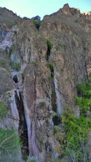
Twin falls. José was barefoot at the top of the 350′ high wet streak, lower left.I stuck to the main trails for the first 15 years.
I met Jose Manuel Torres in the Upper Hot Springs. He was sipping strong posh liquor and washing his cowboy hat, and himself. Then he took off on a trail I’d never noticed. I asked to come with. It became the most spectacular trail I’d ever been on, including some easy but very exposed climbing, ending midway up a series of waterfalls totaling some 1000 feet high. We sat on what I call Flying Saucer Rock hovering above the gorge. He told me not to come further and shed his tire-sole sandals.
For 40 minutes I watched this 68-year-old risk his life on the slick near-vertical rock between the waterfalls to collect a handful of sticks coated with gomilla, a hard resiny orange substance left by scale insects and used as food. My heart was in my mouth, though I’ve been a professional tightrope artist. He then cut and fitted a bunch of 2-liter bottles into a long tube he stuck in the falls. I didn’t understand his explanation, but he agreed that it was some kind of trampa, or trap. (Spanish wasn’t either of our native tongues). Now I can see trails going everywhere.
Under the full moon from Inner hot springs. Jon mesmerized by diamond clouds. Know what causes these?On top, in winter, there’s periodic snow. It’s usually warmer in the day than here in the Boulder/Denver area, but about as cold at night, at about 8000′ altitude. In the bottom, a mile below, it’s warm enough for some orange groves and the occasional banana tree. It’s gotta be the nearest subtropical place to Colorado. For 8 months, it’s a reflector oven in the bottom, and most of the natives leave for the highlands.
Midsummer the rainy season thunders down, and it’s dangerous in the narrow parts of the canyon. In 2010 a very localized 500-year flood tumbled 15-foot boulders and washed away a mature grove of 60 orange trees and 10 feet of soil beneath. If that sounds sounds intense, consider: in the top photo, the gaps uphill of the huge rocks within the river bends are eroded when the river rises that high (over 300′)and shortcuts behind the rocks (the “incisors” in the incised meanders). You don’t want to be down there then!
Iridescent clouds occur when all droplets are about the same size.The rivers that carve the Copper Canyons rise from the same Continental Divide our Colorado River springs from, just further south. The Divide is lower but gnarlier there: Until 1961, a 700-mile stretch of Divide there could only be crossed by foot or burro. In 1961 the railroad came through, which took Mexican, American and Swiss companies a century to complete. It’s considered the best mountain railway in the world.
Nicole’s last sunset.By now there are also 2 paved roads and 3 dirt roads—in 700 miles! Think how many roads and rails cross the Divide in all of Colorado and Wyoming. The Colorado River is 1450 miles from the Divide to the Pacific.
Down there, the rivers only take about 300 miles from the Divide to the Pacific. So the scenery is action-packed.
_________________________________________________________________________________________________________________Evan Ravitz hides and guides in Copper Canyon, when he isn’t editing or agitating. He loves to talk about Mexico: evan (at) vote (dot) org


Read 2 comments and reply